The History of Norbury Park
Geology
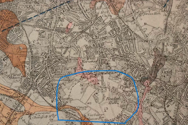
The landscape of Norbury Park is shaped by its rich geological history, primarily composed of London Clay (shown in grey on the map) with pockets of river gravel (marked in orange) to the west.
The area is home to numerous natural springs that feed into Norbury Brook, a waterway with a fascinating journey. Originating near Lower Addiscombe Road, the brook weaves its way through Thornton Heath, alternating between underground channels and open-air sections. As it enters Norbury Park near the allotments, it briefly flows above ground before disappearing beneath the park, re-emerging at the corner of Kuala Gardens, and continuing along the park’s edge.
To enhance flood protection, the Environment Agency is exploring plans to restore Norbury Brook’s natural course through the park by bringing it back above ground. The Friends of Norbury Park enthusiastically support this initiative, recognizing its potential to enrich the park’s beauty and ecological diversity.
The History
The history of Norbury Park is a fascinating journey through time, shaped by changing ownership and land use.
In 1606, the land was purchased by Pembroke College, Cambridge, from St. Bee’s Grammar School in Cumberland. By 1838, records show that while the college still owned the land, it was rented by Chas Fauntleroy, who resided at the Hermitage. The Hermitage was a house between Green Lane and the park that was home to several notable people, including a music hall star and a boxing champion. It was destroyed by fire in 1898.
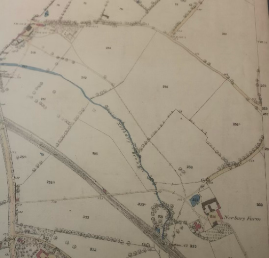
The 1860s map reveals a pastoral landscape of arable fields and grassland, but by 1894, the land had taken on a new purpose as the Hermitage Sports Ground, home to an 18-hole golf course known as North Surrey Golf Course. The Hermitage itself was acquired as the golf clubhouse, though it tragically burned down just a year later.
Even into the early 20th century, the land retained its rustic charm. During the summer, sheep en route to London markets would graze on the golf course during the week. On weekends, they were safely tucked away in a pen near the old police station—protected from flying golf balls!
North Surrey Golf Course
In its days as a prestigious golf course, Norbury Park was an exclusive retreat. In 1905, membership fees for the North Surrey Golf Club were steep—an entrance fee of 6 guineas (£6. 6s. 0d.) and an annual subscription of 4 guineas (£4. 4s. 0d.). To put this into perspective, local annual rents ranged from £35 to £100, meaning golf fees amounted to 10–35% of the average rent. For a Shropshire farm worker earning just 5 shillings a week (about £13 annually), the entrance fee alone was half a year’s wages—making golf a luxury few could afford.
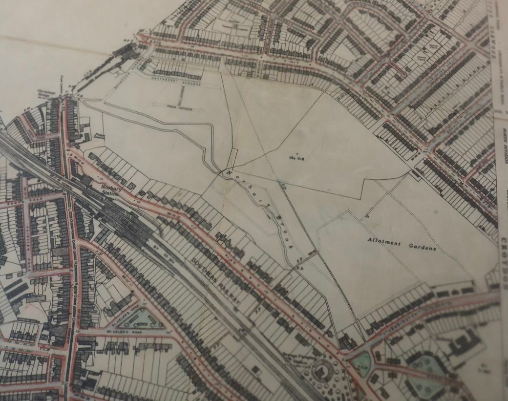
By 1935, the land had been purchased by Croydon Council, yet maps from 1938 still labeled it as North Surrey Golf Course. However, the park’s role soon shifted dramatically during World War II, when half of the grounds were repurposed for allotments to aid food production. The war also left its mark—in August 1944, a V1 bomb struck the park, with several others landing nearby, including near the police station, Hermitage Lane, and Norbury Avenue.
Post-war changes continued to reshape the landscape. The 1967 map shows the addition of Norbury Manor Girls' School, built on former wartime allotments. Further development in the park’s northwest corner made way for sheltered housing, and between 1967–1970, the first playground was created, bringing joy to local children.
As Norbury Park transitioned into a cherished community space, it became a hub for local events. Residents fondly remember the Donkey Derby, a lively summer tradition that brought families together every July in the 1970s—a testament to the park’s transformation from an exclusive golf retreat to a vibrant public space for all.
The Historic Landscape of Norbury Park
Nestled between London Road, Norbury Avenue, and Green Lane, Norbury Park is steeped in history, with each bordering road telling a fascinating story of the area’s past.
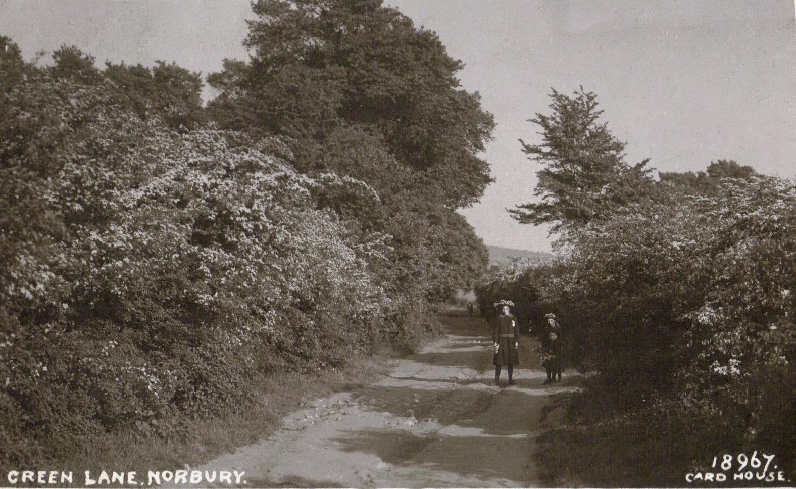
Green Lane: A 2,000-Year-Old Livestock Route
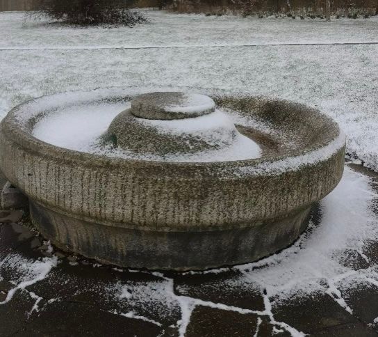
To the north of the park, Green Lane has existed for centuries. A 1762 map by Rocque depicts it as a simple track, but research by historian David Clark traces its origins back at least 2,000 years. Farmers once herded their livestock along this route to sell in London markets, contributing to the name "Lambeth," which means “where sheep were shipped”—likely ferried across the river into the city. A water trough in the park marks a spot where animals once paused to drink before continuing their journey.
Even into the early 20th century, Green Lane resembled a quiet country road. Between 1919 and the 1930s, houses were built between the park and the lane on land once owned by Pembroke College, Cambridge.
London Road: From Roman Times to Highwaymen’s Hideouts
To the west, London Road has been a key route for centuries. Originally a Roman road, it crossed Norbury Brookwhere Hermitage Bridge now stands. This area has long been a place of movement and intrigue. Near the bridge, on Hermitage Lane, stood a pub and a row of cottages—rumored to have been used by highwaymen. These notorious bandits would spy on wealthy travelers stopping at the inn before lying in wait further down the road to ambush them.
Norbury Avenue: A New Addition to the Landscape
Running along the southern edge of the park, Norbury Avenue is a relatively modern addition. Absent from early maps, it was later developed to connect the area to Norbury railway station, which stands at its southernmost point.
Norbury Station: Built for Travellers—and Racegoers
When Norbury Station first opened in 1878, Norbury Park was still farmland. However, the area was already attracting visitors, thanks to a bustling racecourse nearby. This explains why the station was built with ramps instead of steps—to accommodate the large crowds attending race days. In 1903, the station was rebuilt, just as the park had been transformed into a golf course, further cementing its role as a gateway to leisure and recreation.
From ancient farming routes and Roman roads to highwaymen’s hideouts and railway expansion, the area surrounding Norbury Park has played a vital role in London’s evolving landscape. Today, it remains a cherished space, rich with echoes of its storied past.
